Architecture, Gardens, and Local Flavors: A Journey Through Key Cities of the US and Canada
The cities of the eastern United States and Canada sit close enough together on a map to suggest easy comparison, but each has developed a character specific to its geography, its founding culture, and its particular version of North American ambition. Moving between them reveals a continent that varies more than the shared language implies.
Washington DC
Washington DC was planned before it was built, and the grid of diagonal avenues overlaid on the city’s street plan – Pierre Charles L’Enfant’s 1791 design – still governs how the city feels to move through. The National Mall running from the Capitol to the Lincoln Memorial is the civic spine of the city, flanked by the Smithsonian museums that represent one of the greatest concentrations of free public cultural institutions anywhere in the world.
The train from DC to NYC on Amtrak’s Acela service takes around two hours forty-five minutes on the fastest runs, and the Northeast Corridor route is the most heavily used rail line in the United States. The station at Washington Union Station, a Beaux-Arts building from 1908 with a barrel-vaulted ceiling modelled on the Baths of Diocletian in Rome, is one of the finest railway stations in America and worth arriving at with time to look at before boarding. The Acela connects DC not only to New York but to Philadelphia, Baltimore, and Boston along the same corridor, making the entire northeastern seaboard practical to cover by rail without the security and transit friction of flying.
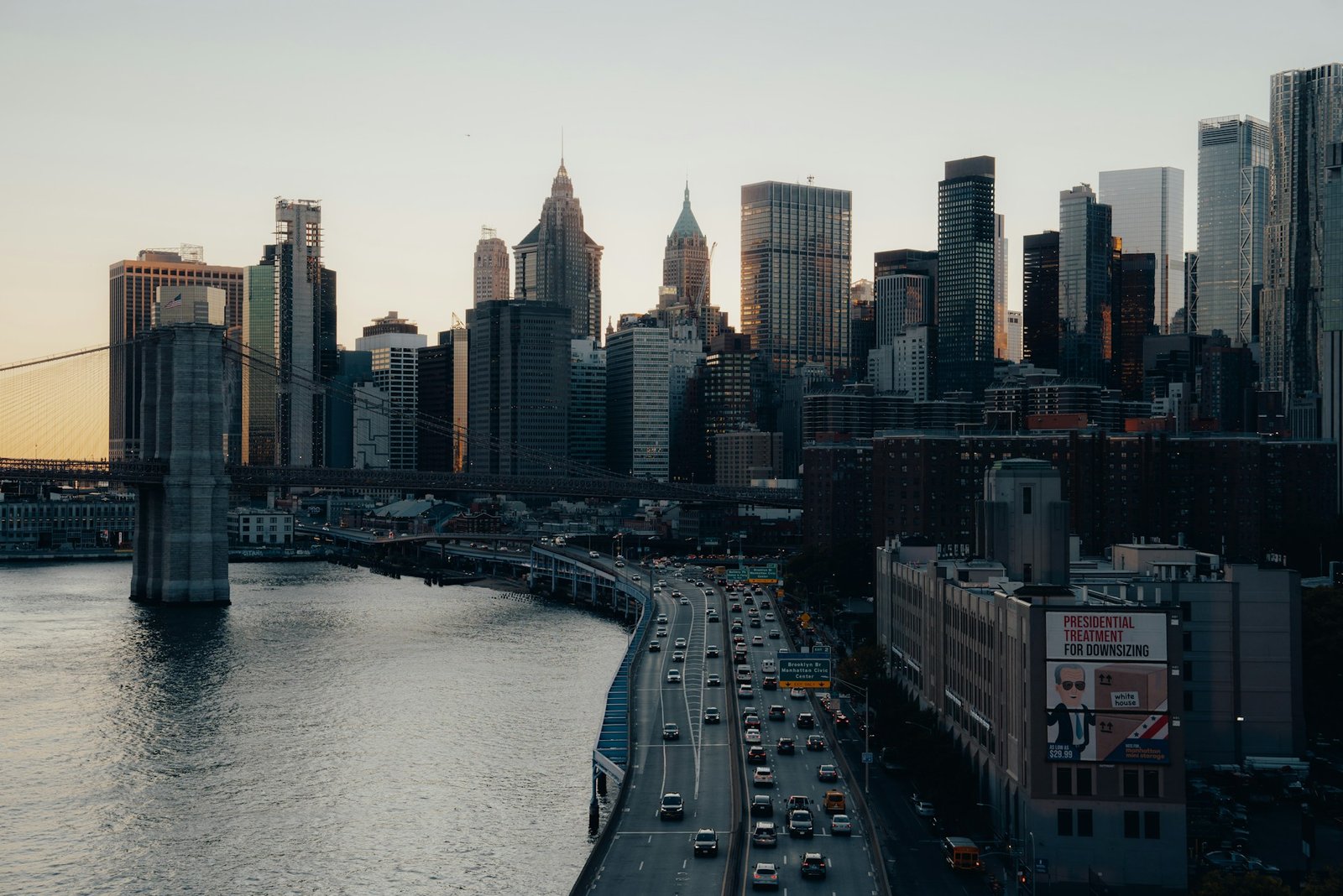
New York City
New York is the American city that most resists summary and most rewards simply moving through it at ground level. The five boroughs cover 783 square kilometres and the variation between them – Manhattan’s density, Brooklyn’s neighbourhood structure, the parkland of Staten Island, the streetscape of the outer Bronx – makes “New York” a container for multiple distinct urban experiences. Central Park is the 341-hectare green space that makes the density of Midtown and the Upper West Side liveable, and the Conservatory Garden in the northeast corner, the Ramble in the centre, and the Great Lawn in the north give the park enough internal variety that a morning there doesn’t feel repetitive.
Montreal
Canada Trains via VIA Rail connect Montreal to Quebec City in around three hours, to Ottawa in two hours, and to Toronto in around four and a half hours, making the city a practical hub for exploring the St Lawrence corridor by rail. The overnight train from Montreal to Halifax on the Maritimes route is one of the most scenic long-distance services in North America, crossing New Brunswick and Nova Scotia through terrain that changes from river valley to boreal forest to coastal marsh. The route is slow – around 22 hours – and the train is not fast, but the dining car service and the observation dome car make the journey an experience rather than simply a transit.
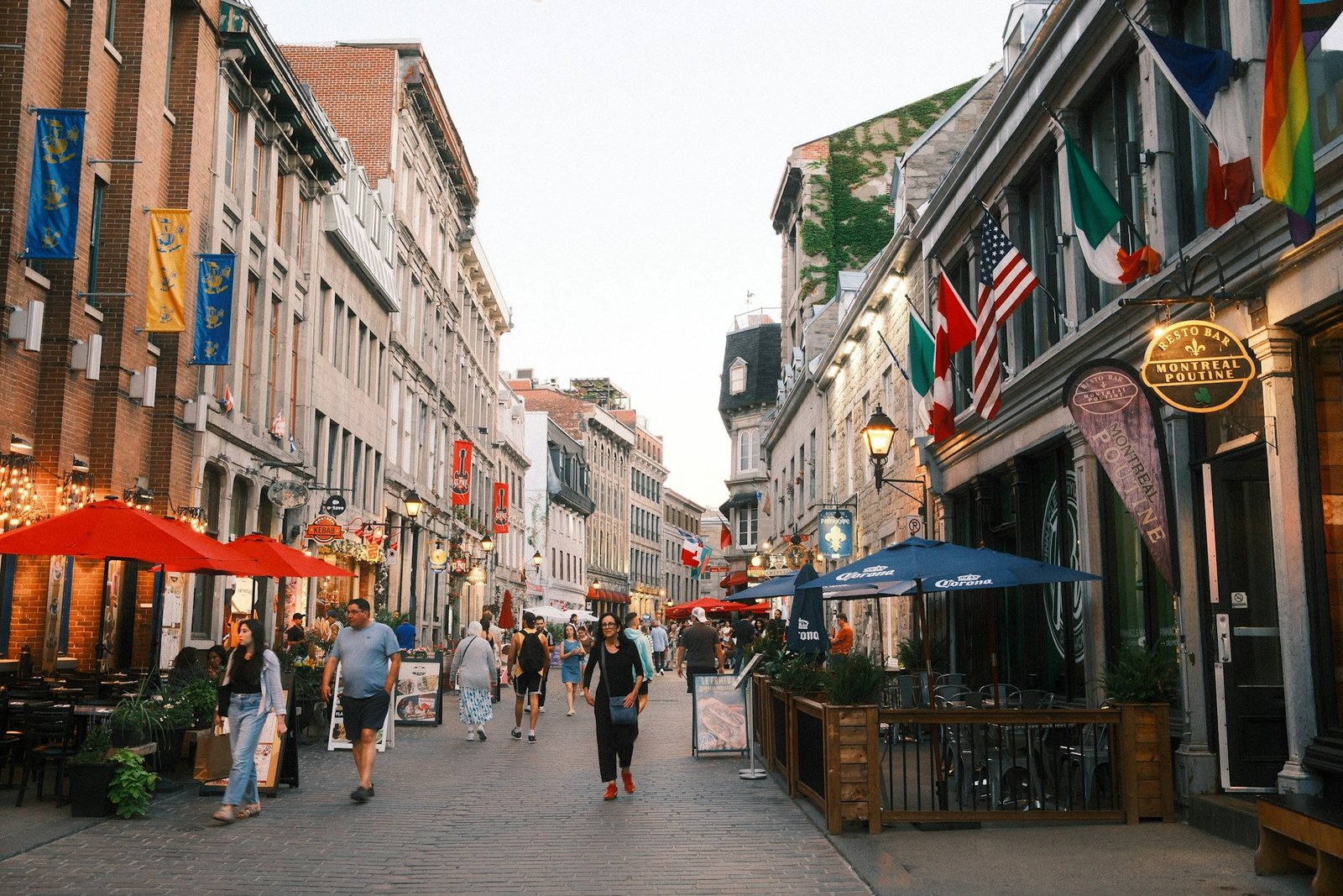
Montreal sits 500 kilometres north of New York and operates in French in a way that takes some adjustment even for visitors who know the language – the Québécois idiom, the unilingual service in many shops and restaurants, and the cultural context of a city that has been navigating its relationship with English Canada for two centuries give it a character unlike any other North American city.
Toronto
Toronto is the city that most surprised visitors to Canada tend to mention. The expectation is a functional but unremarkable city overshadowed by Montreal’s personality and Vancouver’s scenery; the reality is a city of unusual diversity – over half the population was born outside Canada – with a neighbourhood structure that reflects that plurality directly. Kensington Market in the city centre is the most compact expression of this: a few square blocks of West Indian roti shops, Portuguese fish stores, Mexican taquerias, and vintage clothing stores operating within walking distance of each other in a market environment that predates the current food hall trend by several decades.
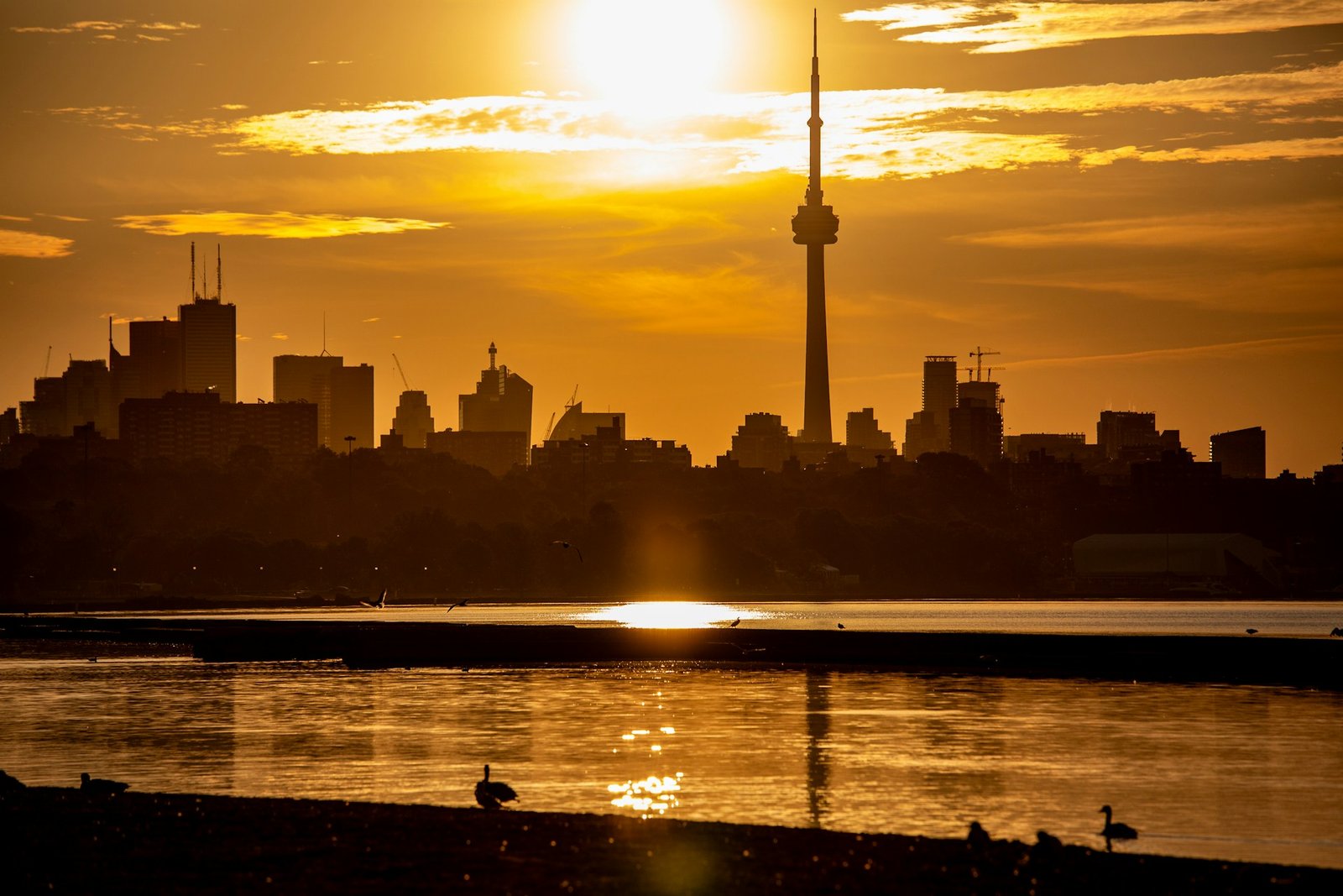
The Toronto Islands, a short ferry ride from the downtown waterfront, give the city a green escape that most lakefront cities of comparable size don’t have. The islands cover around 820 acres and are largely car-free; rental bikes connect the main island to the eastern and western sections, and the view back to the city skyline from the south shore of Centre Island is the angle from which the CN Tower and the downtown towers read best against the lake.
Quebec City
Quebec City is the oldest city in Canada, founded in 1608 by Samuel de Champlain on the banks of the St Lawrence, and the walled Upper Town is the only fortified city north of Mexico in North America. The walls are walkable in their entirety – around 4.6 kilometres – and the Citadelle at the highest point of the promontory gives views over the St Lawrence and the plains to the south that explain why Champlain chose the location. The Château Frontenac, the grand railway hotel built by the Canadian Pacific in 1893, dominates the skyline from every angle and is the building most people picture when they think of Quebec City; the hotel is still operating and afternoon tea in the Le Champlain restaurant is worth the price as an experience of a certain kind of formal Canadian hospitality that hasn’t entirely disappeared.
Conclusion
Moving through the cities of the eastern US and Canada by rail gives a ground-level sense of the continent’s scale that flying erases. The stretch from Washington to Montreal covers around 800 kilometres of the most historically layered terrain in North America, and each city along it has a reason to exist that is visible in its street plan, its architecture, and the way its residents move through it. Slow travel on this corridor reveals a continent that is far more varied than its shared language suggests.